
It allows quick and high quality production in a wide variety of projects including:
The 12d® Model™ Base Product was written from the ground up for the civil and surveying market. Work flow follows traditional engineering ideas, making it very easy to learn and use.

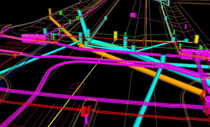
Alignment design adds another dimension to 12d® Model™, providing the tools to carry out the full range of civil design work, from land development to multi-lane highways with major intersections and exits.

There are two parts to the volumetric module, volume calculations and tin analysis. Calculations of earthworks volumes within a user defined polygon using either end area or exact calculations.

The Track module is an extension to the Alignment and Volumetrics & TIN Analysis modules. This module has the extra functions to complete track and rail design. In this new version the Super Alignments have new Rail spiral types, Chainage equalities, Compound elements, Duplicate elements (double tracking)
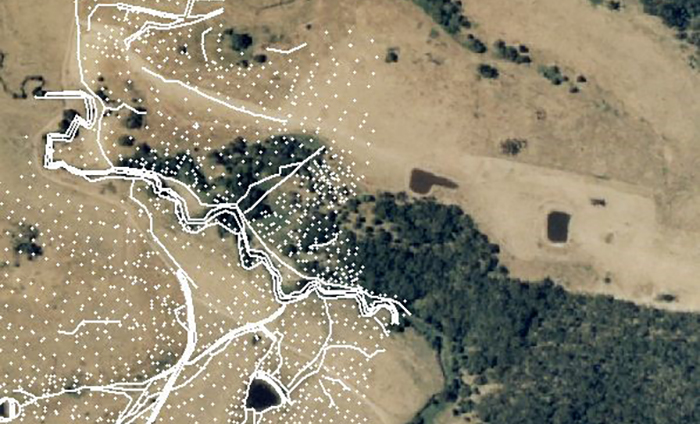
With the Survey module, users are able to graphically reduce and edit survey data, apply adjustments and transformations, create and label subdivisional (estate) lots and create upload setout data. The graphical Cadastral traverse spreadsheets are included.
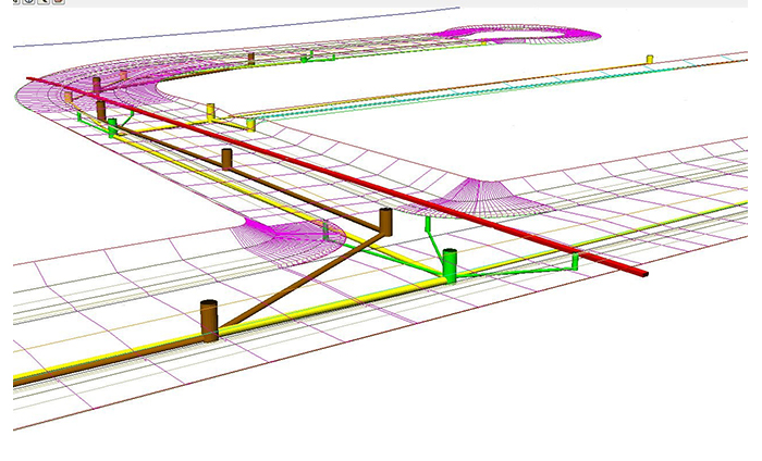
The Drainage module allows the design and management of horizontal and vertical drainage networks, typically those required for new land subdivisions and development projects. Existing drainage networks can be reproduced easily for analysis or realignment designs.
The drainage analysis module allows for hydrological and hydraulic analysis of a drainage network. Site specific rainfall data can be entered and stored in a rainfall file that can be utilised across many projects.
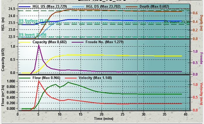
The dynamic drainage module allows detailed hydrological and hydraulic modelling based on volumetric (hydrograph) methods and hydraulics based on the St Venant equation.

12d® Model™ Rivers modules offer river engineers and mappers new levels of flexibility, power, and productivity. 12d® Model™ substantially reduces modelling setup time for river, flood plain, and open channel studies.
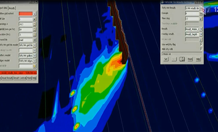
The 2D RoadFlow module allows rapid setup of a 2D model, based on the “rain on grid” analysis mode. To run the model, the user simply needs a surface tin, a model extent defined by polygon, initial rainfall intensity information and surface material “n” values to enable a 2D overland flood model to be initialized and run.

The interface provides users with the complete command and structure control to compile the TCF file. The Interface also allows an existing tcf file created via typed input to be read and run within 12d Model, with the results viewed and interrogated also in 12d Model.

The 12d Drainage 2D 100,000 12d cells combines the functionality of the Tuflow Interface module (separate module purchase) without the need to have a separate TUFLOW license and limits the amount of 12d cells or grids the analysis can be calculated from.
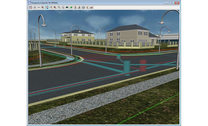
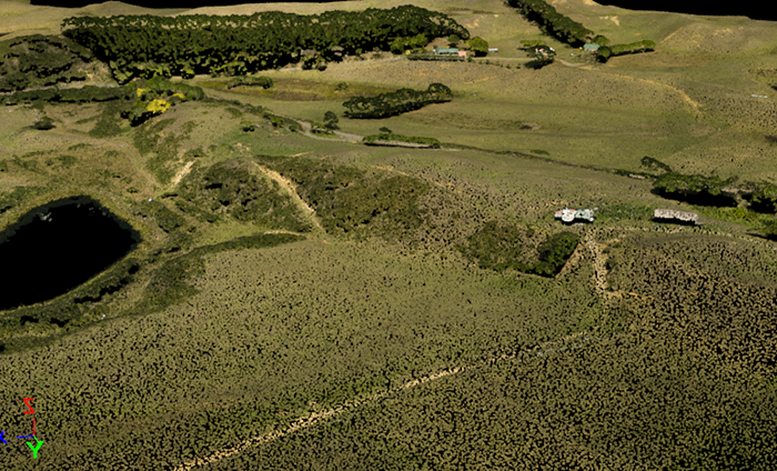
The Visualisation module uses Windows OpenGL to quickly produce realistic perspective scenes of your design. Surfaces can be shaded, photos draped onto the terrain, textures applied to triangles and shapes extruded along strings

This module provides an interface between 12d® Model™ and other spatial information systems such as GIS and Web Mapping utilities through the use of open source FDO (Feature Data Object) technology.

This module enables the reading and writing of vendor independent ADAC XML files (Asset Design As Constructed) as governed by the organization IPWEA. This format is designed specifically for 3D data sets and is intended to allow for spatial asbuilting of survey accurate public and private assets.
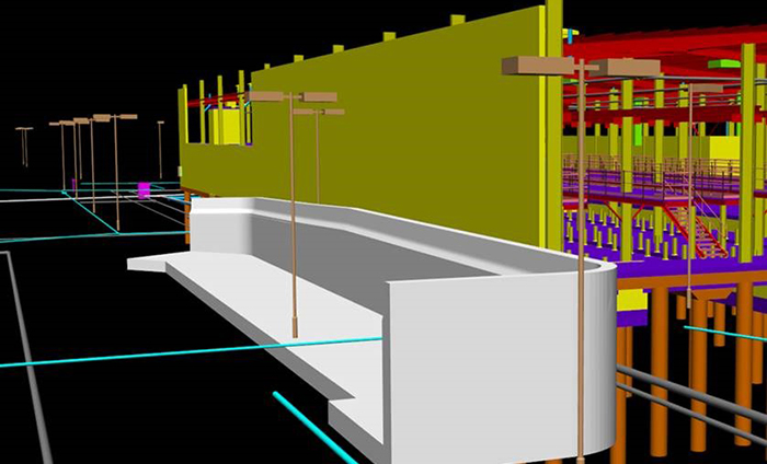
The Civil industry never stands still! Years ago, only alignments and cross sections were used for design. Next, string design was introduced to model the complex geometries that cross sections couldn’t handle...and now we have Civil BIM!
For further informations, advice or assistance, please click on the "Request Quotation" button