eBee X Fixed-Wing Drone

The eBee X is the fixed-wing drone for all your mapping needs. Designed to boost the quality, efficiency and safety of your data collection, it has a camera to suit every job, the accuracy and coverage to meet every project’s requirements, and can work virtually every type of site.
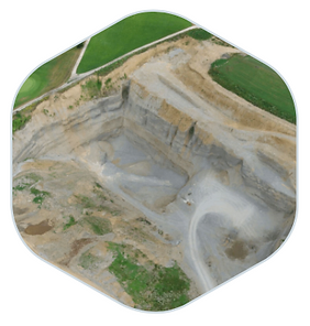
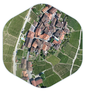
The eBee X can meet the exacting requirements of every project. Its unique Endurance Extension unlocks a maximum flight time of 90 min—for vast coverage of up to 500 ha (1,235 ac) at 400 ft*—while its High- Precision on Demand helps you achieve absolute accuracy of down to 3 cm (1.2 in), without GCPs.
The eBee X allows you to work virtually every site, no matter how demanding, thanks to its space-friendly Steep Landing technology, ultra-robust design, live air traffic data and more—all backed by senseFly’s trusted professional, local support.
The eBee X suits every job thanks to its range of groundbreaking cameras. These include the new senseFly S.O.D.A. 3D, for stunning 3D reconstructions of vertical environments, the best-in-class senseFly Aeria X RGB photogrammetry camera and the senseFly Duet T for creating geo-accurate thermal maps.
The eBee X suits every job thanks to its range of groundbreaking cameras. Just choose the camera, or cameras, that best suit your project needs.
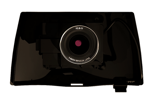
The senseFly S.O.D.A. 3D mapping camera is a unique innovation. This professional drone photogrammetry camera changes orientation during flight to capture three images (2 obliques, 1 nadir) every time, instead of just one, for a much wider field of view. It is optimised for quick, robust image processing with Pix4Dmapper.
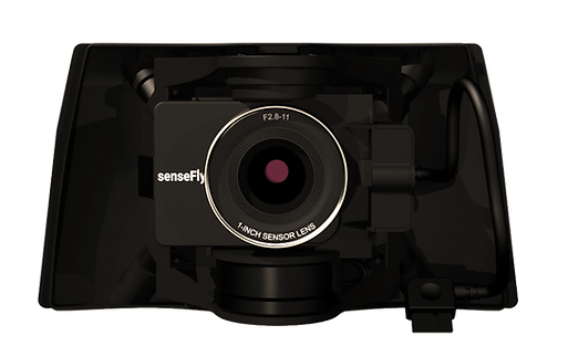
The senseFly Aeria X is a compact drone photogrammetry camera. This rugged innovation offers the perfect blend of size, weight and DSLR-like image quality. It offers stunning image detail and clarity, in virtually all light conditions, allowing you to map for more hours per day than ever before.

The senseFly Duet T is a rugged dual RGB/thermal mapping camera rig. Use it to create geo-accurate thermal maps and digital surface models quickly and easily.

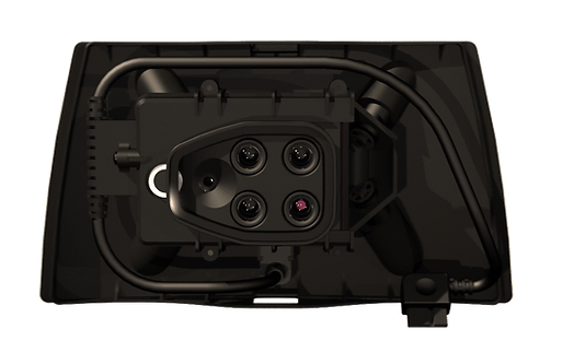
The RedEdge-MX is a rugged and precise multispectral camera for advanced agricultural analysis. This high-performance tool captures both the spectral bands required for crop health indices (green, red, red edge and near-infrared), a blue band for deeper insights into specific issues, plus composite RGB imagery.
Parrot Sequoia+ is the smallest, lightest multispectral camera ever released. It captures images across four defined, visible and non-visible spectral bands, plus RGB imagery, in just one flight.
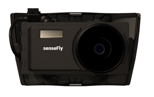
The senseFly S.O.D.A. is the first photogrammetry camera to be built for professional drone use and has quickly become the reference sensor in its field. It captures amazingly sharp aerial images, across light conditions, with which to produce detailed, vivid orthomosaics and ultra-accurate 3D digital surface models.
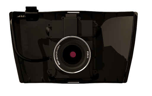
senseFly Corridor simplifies the drone mapping of linear infrastructure and sites. This integration kit houses the senseFly S.O.D.A. (not supplied) in a longitudinal, or portrait, position, while senseFly Corridor flights are managed via the corridor mapping mission block within eMotion 3.


For further informations, advice or assistance, please click on the "Request Quotation" button