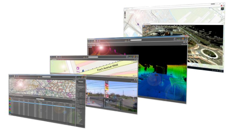
Complete software suite to manage, extract and share 3D data
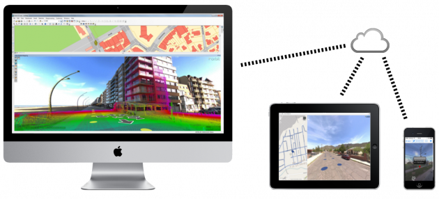
Manage and optimize your mobile mapping data after capture using the powerful 3DM Content Manager. Auto produce & update assets faster and richer than ever before based on the 3DM Feature Extraction portfolio. Install the 3DM Publisher on-premises or activate your profile on 3dmapping.cloud to share mobile mapping projects over the internet, embed in corporate software, or to make them available via mobile devices.
limitless imagery & point cloud
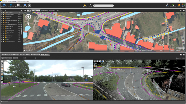
However mobile mapping data is collected, with imagery either panoramic or planar, with or without a point cloud, Orbit supports all. Manage clearly all single runs and bundle raw data into manageable projects. Clean up artefacts, control positional accuracy, consolidate and deliver.
produce, extract and share
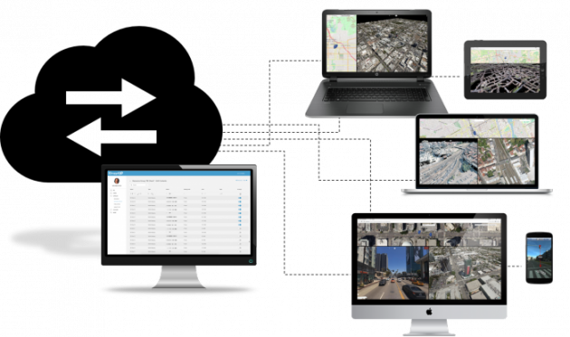
Manage your content, extract and process, and open your market to new consumers, all within one platform. Maximize your efforts and let the data do the work.
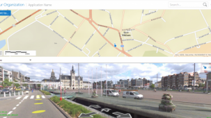
publish to the web and mobile devices
Orbit’s 3D Mapping portfolio provides the tools to publish mobile mapping content and extracted features & assets online, either via 3dmapping.cloud or on-premises. View, share and analyse your mobile mapping resources from any webbrowser, app, or 3rd party software plugin.
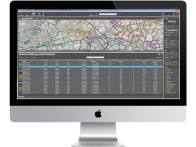
navigate terabytes at ease
Orbit optimizes all 3D data for performance. Roam through terabytes of point clouds easily and combine with imagery, vector and raster data. Limitless. Easy. Fast.
measure, overlay, extract, assets, profiles, volumes, clash detection, blurring
Orbit’s intelligent Feature Extraction solutions provide manual, semi-, and automated measurements, overlays, asset inventory workflows, clash detection, profiles and cross sections, volumetric analysis, blurring of faces and plates including QC to comply with privacy legislations.
embed and integrate in any host
Orbit’s Publishing SDKs and APIs allow anyone to access mobile mapping content from within their workflow, business intelligence tools, or any host such as your favorite GIS or CAD system e.g. ArcGIS, ArcOnline, AutoCAD, QGIS, MicroStation and more.