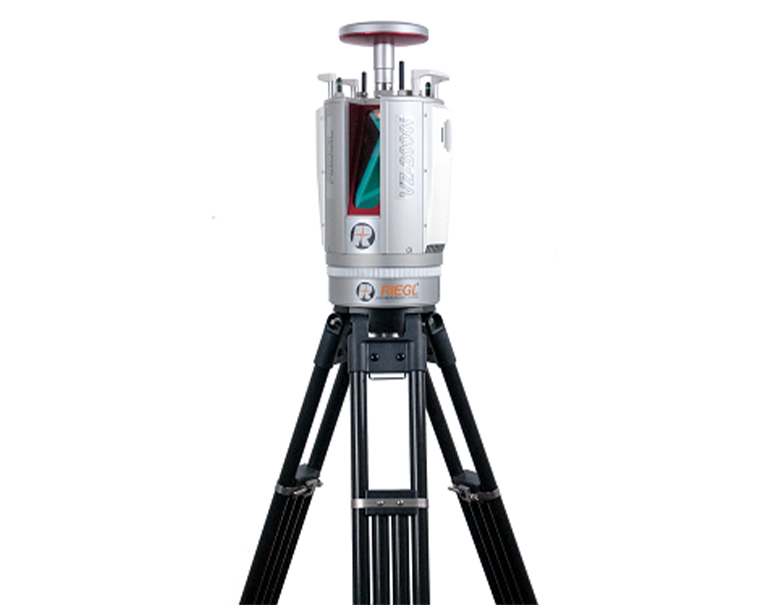
L A S E R S C A N N E R

RIEGL VZ-2000i

RIEGL VZ-2000i

Back

RIEGL VZ-2000i

Based on a future-oriented, innovative new processing architecture, internet connectivity, and RIEGL's latest waveform processing LiDAR technology, the RIEGL VZ-2000i Long Range 3D Laser Scanning System combines proven user friendliness in the field with fast and highly accurate data acquisition.

Its new processing architecture enables execution of different background tasks (such as point cloud registration, geo- referencing, orientation via integrated Inertial Measurement Unit, etc.) on-board in parallel to the simultaneous acquisition of scan data and image data. A full documentation of the scanner‘s software components – directly accessible on the RIEGL VZ-2000i – provides a sound basis for creation of your own python apps to enhance the scanner functionality. The system provides highest flexibility by supporting numerous peripherals and accessories such as the integrated GNSS unit for high accurate RTK solution, a SIM Card slot for 3G/4G LTE, WLAN, LAN, USB, and different other ports of external units.
RIEGL's unique Waveform-LiDAR technology is the key to enabling such high speed, long range, high accuracy measurements even in poor visibitlity and demanding multi-target situations caused by dust, haze, rain, vegetation, etc.

Main Features


  • High laser pulse repetition rate of up to 1.2 MHz
  • High speed data acquisition up to 500,000 measurements/sec
  • Eye safe operation at Laser Class 1
  • Wide field of view, 100°x360°
  • Range up to 2500 m, accuracy 5 mm
  • High accuracy, high precision ranging based on echo digitization, online waveform processing, and multiple-time-around processing
  • New, innovative processing architecture for data acquisition and simultaneous geo-referencing in real-time
  • Automatic on-board registration
  • simultaneous image and scan data aquisition
  • Cloud connectivity via Wi-Fi and 3G/4G LTE
  • Multiple target capability
  • Optional waveform data output
  • Orientation sensor for pose estimation
  • Remote control
  • Integrated GNSS receiver
  • Fully compatible with the RIEGL VMZ Mobile Laser Mapping System
  • Main Applications


  • Topography & Mining
  • Surveying in Open-Pit Mining
  • Archeology & Cultural Heritage
  • City Modeling
  • Civil Engineering
  • Monitoring
  • Forestry
  • Research
  • Stand-alone Static and (within RIEGL VMZ) Mobile Laser Scanning
  • Download


    Do you need Quotation ?

    For further informations, advice or assistance, please click on the "Request Quotation" button